Balboa, Cauca, Colombia
Suggest Place to Visit
758
Track to location with GPS |
 |
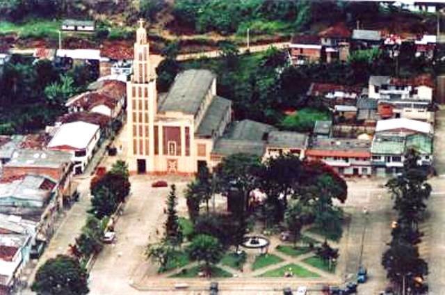
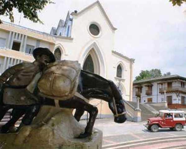
The origins of Balboa go back to the time when Demofilo Pino and other Caucanos began the colonization of the Risaralda valley, they founded the villages of Calabaza and Cañaveral. By the time the Thousand Day War ends, human advances over the mountain range are a reality. Around the calends of 1903, a traveler from Pácora, named Miguel Ceballos, built an inn which he called the Alto del Rey and which would serve to indicate the original place of the future Balboa. At the time of the conquest, its inhabitants were the Guáticas. The current foundation dates from 1907. Among the colonizers of the region, Juan Bautista, Julián Benjumea, Pedro Benjumea and José Miguel Caballos are mentioned. For the year 1912, he was named a township of the municipality of Santuario. In 1923 the governor of Caldas called this settlement by the name of Balboa for the first time, establishing itself as a municipality. The early proposal to transfer the municipality of Balboa dates from the year 1923. Its situation is quite complex because in the place where it is erected it is prone to landslides. For this reason, at the beginning of the century, the proposal to relocate it to the plains near the municipality of La Virginia was already circulating in the department. The Balboa of the 1940s had no roads. Its main street was cobbled and through it large trains of mules loaded with coffee and groceries crossed, coming from areas such as El Águila, Villanueva and Patio Bonito. In those times, work was plentiful; this situation was lived out for several decades, despite the violence of the fifty that in the municipality brought its cost of victims. For many years its economy was centered on coffee production, and with its crisis, the level of poverty among the peasants of the region grew alarmingly. These people have spent years of worthy struggle, clinging with love to this mountain where their homes and their past are located. The main street of the town is narrow, and their life circulates through them: the beautiful young women from the schools, the peasants from the nearby sidewalks always attentive, alert to any job opportunity that comes their way. A particularity of the municipality is that it unfolds without opposing the slope from a road that articulates its park and main square in its entirety, tending towards an elongated urban configuration, in which streets break in a minimal way in a transversal sense, and yes a considerable amount of stairways, which continuously and surprisingly provide visual leaks, which end on some urban components or on the great valley of Risaralda, giving it a special landscape attribute. The modest dimensions of its structure and the special notion of scale that it handles with respect to its inhabitants, determine it as a warm and human urban space, endowed with a public space full of variants, loaded with meanings and at the same time with places with their own identity that , in some cases, they become local landmarks; There is no place with a similar appearance to another and the streets are mostly framed between homogeneous walls, at certain times, of marked architectural value and as a whole in the heritage area, such as in the initial section of access to the population . The percentage growth rate of the population in 2000 was 11.89%, in 2001 it was 8.71%, in 2002 it was 11.77% and in 2003 it was 9.87% In the year 1908, the Owner of the lands that today the Balboa settlement occupies, Mrs. Leonor Agudelo, donated them, beginning the appearance of the town. The name Alto del Rey is due to the figure of a chief found by the local people.
The municipality of Balboa is located in the Department of Risaralda, at a distance of approximately 52 kilometers from the capital Pereira. It belongs to the central-western region of the country on the eastern slope of the western mountain range, and its slopes descend towards the Cauca, Risaralda, Cañaveral, Monos and Totui rivers.
Limits of the municipality:
It borders the municipalities of La Celia, Santuario, La Virginia, Pereira in the department of Risaralda, and with the municipalities of El Águila and Anserma Nuevo in the department of Valle.
Total extension: 11,926 kMS2 Km2
Urban area extension: 11,000 km2 Km2
Rural area extension: 923 km2 Km2
Altitude of the municipal seat (meters above sea level): 1,356 m.a.s.l.
Average temperature: 20º Cº C
Ecology
Regarding the coverage and use of the land, in Balboa it is found that coffee (4,225.8) ha), managed pastures (3,173.4 ha) and sugar cane (2,078.1 ha), represent approximately the 78.25% of the total area. 30% of the total planted area belongs to permanent and semi-permanent crops among them, Avocado, Banana, Cacao, citrus, lulo, papaya, Dominican intercropped hartón plantain and blond tobacco, being the predominant annual crop in the municipality La Yuca, which represents 1.28% of the total cultivated area in the municipality; transitory crops represent 11.2% of the total planted area, corn and beans being the most representative; and on a smaller scale we have the bean and the chonto tomato. The villages with the highest participation in the agricultural part of the Municipality are Chuscal, Cocohondo, La Floresta, Guaimaral and Llano Grande.
Economy
The coffee monoculture has been the most important line in the economy of the municipality of Balboa Risaralda that contributes to the generation of employment. The sugar cane, yucca, grass and other minor crops such as bread, are part of the productive means that generate employment for the Balboense community. Local commerce, informal employment, institutions such as Mayor's Office, Hospital, Firefighters and Coffee Growers Committee, Household Public Services Company are in charge of generating 100% of employment in the municipal seat. The economy of the Municipality in the urban area is dedicated to the sale and purchase of different products that are part of people's daily lives. The most representative businesses in their ascending order are warehouses with 10%, stationary sales with 10%, shops and revolvers with 7.5%, miscellaneous with 7.5% and other activities that represent 64%.
Communication channels
Aerial:
The climatic behavior in Balboa is determined by the characteristics of the relief and by the circulation of the atmosphere in the tropics, which defines two rainy periods a year with maximums in April - May and October - November. The average annual temperature varies from 23 ° C to a height of 903 m. above sea level and at 17 ° C at an elevation above sea level greater than 1800 m.
Terrestrial:
The use of urban land is given for the actions of subdivision, urbanization and housing construction, in addition to the public service systems, the equipment and the definition of the special management areas, as well as the areas defined as public space. The rural land is destined for the areas of special management, the areas of the provisioning system of public services and for the final disposal of solid waste and the areas of agricultural, forestry, mining production, of tourist interest and the collective equipment for the rural population. In the agricultural zone of the municipality of Balboa, the soil is destined for the cultivation of grass, coffee, banana, yucca, and bread. In the protective forest production zone, existing forests and related species such as bamboo and wild cane are conserved and their recommended use is as protective forest, producer forest and agroforestry systems; activities such as poultry, pig farming and fish farming are carried out in the livestock area; the mining area is used for drag material in the Risaralda, Cañaveral and Cauca rivers. Special management areas such as the Alto del Rey natural municipal park are used for the conservation of natural resources and ecological tourism. In the municipality of Balboa Risaralda, risk and threat zones are used for the construction of civil protection works and forestry practices for their recovery and stabilization. The concession areas are used for road reserves and free areas for urbanizations.
River:
The contamination of water and soils by the indiscriminate use of agrochemicals, the loss and unproductivity of soils and the imbalance of agricultural systems, are some of the problems related to land use in the Municipality. Particularly in rural areas, large areas of coffee have been replaced by cassava crops, in areas where the slope, the climatic characteristics and the soil are not suitable for this type of crop.
To visit:
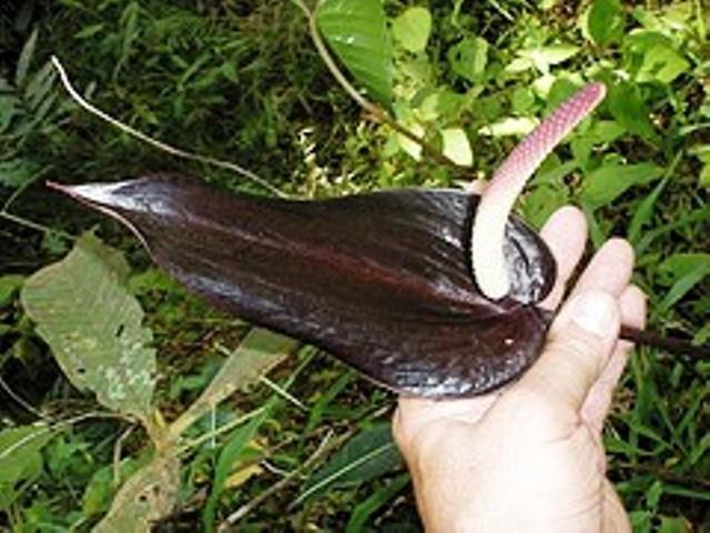
Here you cannot miss the Anturio Negro botanical garden and the landscape that can be seen from various points of the municipality, both in the urban and rural areas. There are several viewpoints to appreciate panoramic views of the region. A place where the Cauca, Cañaveral, Monos and Risaralda rivers cross; with natural landscapes in all its extension and a dynamic livestock and agricultural activity. This is Balboa, the western town of Risaralda, which in 2007 celebrated the centenary of its founding.
Comments
We don´t have yet any comments about:
Balboa
Balboa
Be the first to leave a comment as it is very important to inform other people
Outros locais a visitar
Within a radius of 20 km from:Balboa
Jardín Botánico Anturio Negro |
| 0,7 Km |
 |
La Celia |
| 7,2 Km |
 |
Apía |
| 17,4 Km |
 |
Hotel reservation near Balboa within a radius of 20 km
No results
Why to book with RUTAS TURISTICAS
The best prices
Our partnerships with the world´s largest operators offer research on the best market prices.
More options
At Rotas Turisticos you can book the hotel, buy the air ticket, book the transfer from the airport to the hotel and vice versa, book the local excursions, rent the car, take travel insurance and consult the places to visit and where to go.
Holiday Tips & Destinations
Hundreds of holiday destinations with all the options that allow you to easily choose the destination that best suits your dream vacation.
RUTAS TURISTICAS
Links


