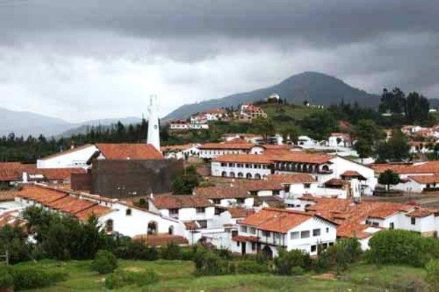
Guatavita, Cundinamarca, Colombia
Suggest Place to Visit
1202
Track to location with GPS |
 |
Over the years, Guatavita has distinguished itself historically and worldwide as the enigmatic legend municipality of “El Dorado”, due to an indigenous past and a tourist future.
Guatavita comes from the Chibcha GUATTAVITA language, which translates into Spanish that says "LABRANZA DE LA PUNTA EL EXTREMO DE LA SIERRA", as the linguist Joaquín Acosta Ortegón says in his Chibcha dictionary.
The Chronicler Fray Pedro Simón. He gives us a very important piece of information in his "Historical News", which gives us the knowledge that Guatavita calls himself Guatafita, which means "he can do it out loud", saying that he has made the spaces that have changed the F to her. V to give more phonetic sweetness to a different name.
LEGEND OF EL DORADO
The origin of the myth of El Dorado, the most famous of those who stimulated the exploration and conquest of the American continent, dates back to 1534, in which an indigenous territory that Colombia occupies in the spaces of one of the ritual ceremonies of the Guatavita cacique, which used to awaken the code of soldiers and adventurers.
The naked body with golden octopuses adhered to its skin by means of a turpentine tincture, the cacique, before his people, embarked alone in the Guatavita lagoon; to link up to the point where the crosses tended perpendicularly from shore to shore, bathing and throwing into the water, in honor of the divinity, valuable offerings consisting of pieces of gold and emeralds. Their songs paid the same tribute.
Starting from a certain conclusion, it was possible to verify the study of the custom of the chibchas, the legend of the golden Indian was disclosed by the conquerors, it spread through the north of South America, it descended to Peru, and from there to some later, in the Silver river; but in the afternoon to incorporate new and fabulous elements that totally misrepresent it.
The myth ended as it had no relationship with the golden cacique, and El Dorado was called to the regions of gold and diamonds from different parts of America, absolutely imaginary, considered the emporium of incalculable riches.
In search of El Dorado they made many expeditions, so many that in 1538, and in a week the three led by Belalcázar, Federmann and Jiménez de Quesada, from Peru, Venezuela and Santa Marta, respectively, coincided in the desolate areas of Guatavita.
Sir Walter Raleigh stands out among the foreigners who dazzled the famous legend, and who led America to a chimera that also had fervent propagandists in Europe.
It was the religious capital of the Chibchas of Zipazgo, in its sacred lagoon, the highest temple of their veneration of Chie, the water, it celebrated the most pompous of its ceremonies that gave rise to the legend of El Dorado. Guatavita in the Chibcha language that wants to decide the edge of the mountain, according to Acosta Ortegón.
The primitive town of Guatavita had a lot of snow on the Montesillo hill, the surrounding area was the captaincy of Chaleche, Tuneche and Tuminé; the main industry was the orphanage, which stood out as the best and the best habit ´´They knew how to melt gold and shape it. The founder of the new town was Miguel de Ibarra, on March 18, 1593 when the contract was awarded. of the lands.
On September 27, 1639, during the visit of Gabriel Gabriel de Carvajal, while he was curing Francisco Chacón de Santo Domingo, he went to see the lands to learn how he was awarded to the Indians, in his position of support. On February 3, 1758, I began to visit the oidor of Aróstegui and Escoto. The population was 1,264 of which 221 were subject to taxes. The cattle census gives 480 people in 160 families. On March 1, 1771, during a visit to Corregidor José María Campuzano y Lanz, 1,577 Indians were sponsored, of which 333 were tributaries.
Juan Tomás de Fresneda was cured and there were 214 white heads of families and 1,064 people. According to the Royal Voting of 1567, Fray Sebastián de Morales was nominated for Guatavita before the Guatavita convent, which received the name of San Pedro Mártir. The priory lasted until 1584 when it fell as vicarage. By royal vote on December 27, 1767, the parish was handed over to the secular clergy in 1768 in exchange for Chiquinquirá. It is not known when it was erected in the white parish.
Since its inception it appears as the capital of the Canton and of the province until 1930, when this political-administrative hierarchy was suppressed, a category that has been maintained until it disappeared in the waters on September 15, 1967. The construction of the new building on November 14 1964 by the firm Llorente y Ponce de León Ltda., In August 1967 the move began. The City consists of 2 family parts that are a set of symmetrical houses where the indigenous and public settlement lives, the civic house where the Government buildings, squares, shops, restaurants, church are located. etc., some relics are kept in the ´´Museum Parroquial´´.
The lake that resides in the Tominé valley, the Guatavita is called ´´Embalse de Guatavita and dam of Sesquilé´´, it covers the municipalities of Guasca and Sesquilé, it has a length of 18 km. by 4 anchors and 38 meters deep, with a capacity for 630 million cubic meters of water. The objective is to regulate the flow of water in the Bogotá River in relation to the needs of the Salto del Tequendama hydroelectric plant, stop the flooding of the Sabana and supply water at the Tibitó plant for water supply in Bogotá.
Notable Facts
The Canton of Guatavita was created by decree of the Congress of New Granada on June 11, 1839. The indigenous village of Guandita is still within its jurisdiction, which was erected in departmental inspection and later suppressed. The first birth in Nueva Guatavita was that of Pedro Alberto Muñoz Delgadillo on September 15, 1967; and the first deficiency was from Ismenia Sastoque on the 21st of the same month that the cemetery was inaugurated.
If it was said that the Guatavita band was founded in 1874 by Alejandro Hoyos Rozo, it was the most famous band in Colombia with the name ´´a single piece like the Guatavita Band´´ that some could interpret as simplicity and poverty. of his repertoire, and that an article by Miguel Aguilera says: ´´but at least in 1882 I will play the band from a polka score composed by Don José María Ponce de León, entitled ´´La Mirla Blanca´´, and I will perform with the band. success.
Cuenca 1964, the band presents a presentation on national television, in which the most successful performers appear; in 1967 it was used differently and in 1971 it began to be reconstituted with new people and some of the same instruments.
The Guatavita lagoon was the subject of multiple works to unload it and extract it from the treasures that lie at the bottom.
The municipality of Guatavita is located in the province of Guavio.
The town hall of Guatavita was moved in 1967 to its current place from where a modern colonial-style settlement was built. The ruins of the previous head are currently at the bottom of the Tominé reservoir. Guatavita means the end of farming in the Chibcha language. In its time it was the center of worship in the water of Chiosa, and the locals were expert orphans, however in the year 1593, Miguel Ibarra, founder of the town, awarded the indigenous peoples of the region. The Town of Guatavita lasted until September 15, 1967, when it was flooded to regulate the flow of water from the Bogotá River, control floods on the savannah, among others. The construction of the new town hall began on November 14, 1964, and in August 1967 the relocation of the settlement began until the official transfer took place on September 15, 1967. Currently the town has squares. , warehouses, government building, among other civic-type buildings.
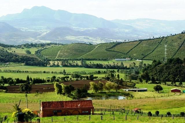
Guatavitas of cold climate, at a height of 2,680 meters above sea level. and for having within its territory an area of moorland ”The winter temperature is given by the general, during the months of June and July, it is characterized by abundant fluvial precipitation. The driest temperature occurs during the months of December and January, giving rise to cold and intense colds.
Livestock and agriculture; the products that are the most difficult: the potato, the grove, the broad bean, the wheat, the corn, among others, also the coal mining. Your soil is very productive.
SITES OF INTEREST IN GUATAVITA
Old indigenous cemetery
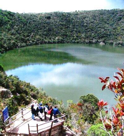
El Dorado Sacred Lagoon
Tominé reservoir
Religious museum
Indigenous museum
Archeological Museum
Obelisk Old Town
Martos Swamp
Plaza de la Cacica
Bullring of the Real Maestranza
Old Town
Lovers Bridge
Humilladero Bridge
Hill of Montecillo
Mohan Cave
Church of the Dolores
Comments
We don´t have yet any comments about:
Guatavita
Guatavita
Be the first to leave a comment as it is very important to inform other people
Outros locais a visitar
Within a radius of 20 km from:Guatavita
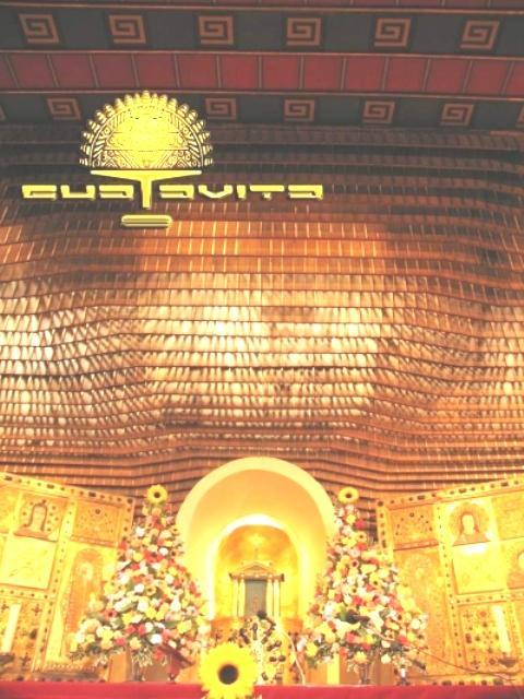
Iglesia Nuestra Señora de los Dolores |
| 0,2 Km |
 |
Laguna de Guatavita |
| 2,1 Km |
 |
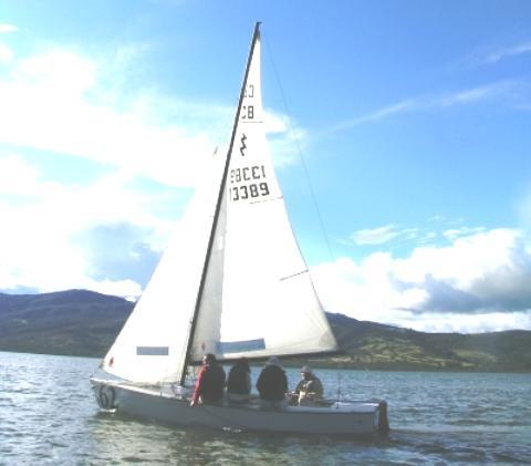
Represa de Tominé |
| 4,0 Km |
 |
Guasca |
| 9,2 Km |
 |
Hotel reservation near Guatavita within a radius of 20 km
Why to book with RUTAS TURISTICAS
The best prices
Our partnerships with the world´s largest operators offer research on the best market prices.
More options
At Rotas Turisticos you can book the hotel, buy the air ticket, book the transfer from the airport to the hotel and vice versa, book the local excursions, rent the car, take travel insurance and consult the places to visit and where to go.
Holiday Tips & Destinations
Hundreds of holiday destinations with all the options that allow you to easily choose the destination that best suits your dream vacation.
RUTAS TURISTICAS
Links


