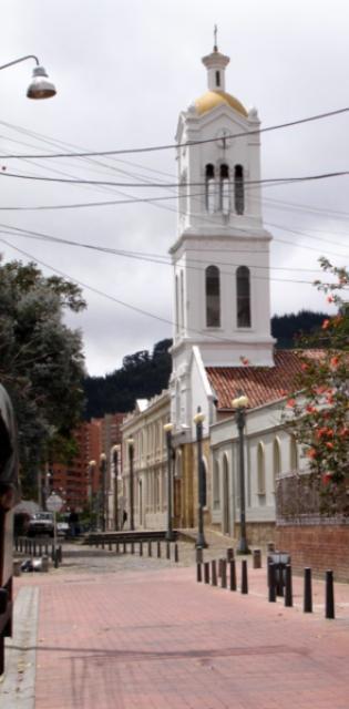
Usaquen


Usaquén, Cundinamarca, Colombia
Suggest Place to Visit
471
Track to location with GPS |
 |
Usaquén was first the Muisca region and then Chibcha, which for the indigenous people meant: ´´Under the pole´´ This obeys a rite where the daughter of an important was sacrificed at the bottom of the hole where the youngest of a few months of age was placed. born to which a heavy stick was made to fall that would serve as a column to a new hut. For the inhabitants of the twentieth and twenty-first centuries this practice seemed terrifying so they invented that it was the “Land of the Sun”, stealing the name from Sogamuxi. It is also said that its name comes from Usacá daughter of Tisquesusa, married by Fray Domingo de las Casas with the Spanish captain Juan María Cortés de Insignares who received the lands of Usaquén as a dowry.
Its name comes from the chief Usaque. It was a Muisca town in pre-Hispanic times, it was founded as an indigenous town in 1539 and abandoned by Spanish decree in 1777, although it was repopulated later, but by people from the capital. Later, it was the scene of the struggles for Colombian independence. It was built as a municipality in 1846 and in 1860, there was a battle between the government troops and those of Tomás Cipriano de Mosquera, who was the winner and took power over the country.
The Usaquén region was of great importance in the colony, whose area covered the lands that today are called La Calera, Chía and Guasca. Around 1539, the town of Usaquén was founded, called “Santa Bárbara de Usaquén”, a title that is still preserved and sponsored by the town's Parish. The houses or huts that formed the headquarters of the chiefdom occupied the western region of the current population one kilometer towards the savannah in the middle of the plain, Usaquén was entrusted to different conquerors. It was the seat of famous estates of the savannah such as Santa Ana, Santa Bárbara and el Cedro, today converted into important urbanizations and commercial centers. In its beginnings, Usaquén was the largest supplier of sand and stone extracted from its quarries, with which the foundations of the National Capitol and the old Palace of Justice, which disappeared in the Bogotazo of April 9, 1948, were laid. an important handicraft activity, in wood carving as well as in textiles; In the Huatay workshop, by Raquel Vivas, the finishes were woven that served to cover the interior of the Apollo 11 spacecraft and all the capsules that went into space from the Apollo program of NASA, of the United States.
On December 17, 1954, with the creation of the Special District of Bogotá, six neighboring municipalities were annexed to Bogotá, including Usaquén.
Until 1954, it was part of the department of Cundinamarca, it had 71 km² and its head was located 12 km from the center of Bogotá, which made its territory pleasant for the wealthy families of the city. With the creation of the Special District in that year, it was integrated into the city, maintaining its institutions as a municipality but under the supervision of the Mayor. On December 31, 1978, in its vicinity, the M-19 guerrilla group took over the military base in Cantón Norte, stealing the military arsenal it had there.
For 1991, the old municipality was erected as a locality by constitutional order. Today it is one of the most important towns in the city.
Regarding the agreements that give birth to the local mayors, the following stand out: Agreement 26 of 1972 creates sixteen Minor Mayors of the Special District of Bogotá, Usaquén going to integrate with other surrounding neighborhoods the Minor Mayor of Usaquén, administered by the Minor Mayor corresponding as nomenclature number 1, with determined limits, and ratified by Agreement 8 of 1977. In 1986 18 illegal residential neighborhoods and some residential, institutional and recreational developments located in the villages of Torca, Tibaitatá, La Floresta were incorporated and Barrancas. Subsequently, the 1991 Constitution gave Bogotá the character of the Capital District; In 1992 Law 1 regulated the functions of the Local Administrative Board, the Local Development Funds and the Local Mayors, and determined the budgetary allocation of the localities. Through Agreements 2 and 6 of 1992, the District Council defined the number, jurisdiction and powers of the JALs. Under these regulations, the Minor Mayor of Usaquén was established, preserving its limits and nomenclature, administered by the Local Mayor and the Local Administrative Board, JAL, made up of 11 councilors.
Finally, Decree - Law 1421 determines the political, administrative and fiscal regime under which the localities operate until today (ciudadbogota.com)
Usaquén is the number one town in the Capital District of Bogotá. It is located north of the city.
General data
Limits
North: Calle 240 with the municipality of Chía (Cundinamarca).
South: Calle 100, with the town of Chapinero.
East: Eastern hills with the municipality of La Calera (Cundinamarca).
West: North Highway with the town of Suba.
The town of Usaquén is divided into nine UPZ (Zonal Planning Units). In turn, these units are divided into neighborhoods, as we see here (some UPZ share neighborhoods):
Paseo de Los Libertadores: Canaima, La Floresta de La Sabana and Torca.
Verbenal: Altos de Serrezuela, Balcones de Vista Hermosa, Balmoral Norte, Buenavista, Chaparral, El Codito, El Refugio de San Antonio, El Verbenal, Horizontes, La Estrellita, La Frontera, La Llanurita, Los Consuelos, Marantá, Maturín, Medellín, Mirador del Norte, Nuevo Horizonte, San Antonio Norte, Santandersito, Tibabita, Viña del Mar.
La Uribe: Bosque de San Antonio, Camino del Palmar, El Pite, El Redil, La Cita, La Granja Norte, La Uribe, Los Naranjos, San Juan Bosco, Los Laureles Urbanization.
San Cristóbal Norte: Ainsuca, Altablanca, Barrancas, California, Cerro Norte, Danubio, Don Bosco, La Perla Oriental, Las Areneras, Milan (Barrancas), Pradera Norte, San Cristóbal Norte, San Cristóbal Norte upper part, San Cristóbal Norte lower part , Santa Teresa, Soratama, Torcoroma, Villa Nydia, Villa Oliva.
Toberín: El Toberín, Babilonia, Darandelos, Estrella del Norte, Guanoa, Jardín Norte, La Liberia, La Pradera Norte, Las Orquídeas, Pantanito, Santa Mónica, Villa Magdala, Villas de Aranjuez, Villas del Mediterráneo, Zaragoza.
Los Cedros: Acacias, Antigua, Belmira, Pine Forest, Caobos Salazar, Capri, Cedritos, Cedro Bolívar, Cedro Golf, Cedro Madeira, Cedro Narváez, Cedro Salazar, El Contador, El Rincón de Las Margaritas, La Sonora, Las Margaritas, Lisbon, Los Cedros, Los Cedros Oriental, Montearroyo, New Highway, New Country, Sierras del Moral.
Usaquén: Bella Suiza, Bellavista, Medina Forest, El Pañuelito, El Pedregal, Cavalry School I, Infantry School, Francisco Miranda, Geneva, La Esperanza, La Glorieta, Las Delicias del Carmen, Sagrado Corazón, San Gabriel, Santa Ana, Santa Ana Occidental, Santa Bárbara Alta, Santa Bárbara Oriental, Unicerros, Usaquén.
Country Club: Country Club, La Calleja, La Carolina, La Cristalina, Prados del Country, Recodo del Country, Santa Coloma, Soatama, Toledo, Torres del Country, Vergel del Country.
Santa Bárbara: Santa Bárbara Occidental, Campo Alegre, Molinos del Norte, Multicentro, Navarra, Rincón del Chicó, San Patricio, Santa Bárbara, Santa Bárbara Central, Santa Bibiana, Santa Paula.
Sidewalks:
Towards the northern end of the town there is the Torca path, the largest in the town and El Páramo are the unofficial paths.
Places of interest
The Colonial Zone, which includes the Parroquia de Santa Barbara (built in 1665 and modernized in the 20th century), the old hacienda of the same name (today Centro Comercial), seminars, schools and the famous flea market.
The Country Club, a social club reserved for high-class families recognized for its wide and green golf courses.
The Unicentro shopping center is one of the largest in the city with buyers coming not only from the town, but from the entire city.
The Santa Ana Shopping Center, located on Avenida Novena, is one of the most exclusive in the city
The Cedritos 151 Shopping Center, located on Diagonal 151 with Carrera 32 (old address).
Palatino Shopping Center located on 140th Street with Carrera 7
Hacienda Santa Bárbara Shopping Center, which unites the modern with the colonial by being built on the land where the colonial house of the hacienda was located, which was owned by Pepe Sierra
The Santa Bárbara Business Complex is a set of tall buildings where there are medical offices, embassies, headquarters of multinationals and national companies, as well as several restaurants, bookstores, cafes and other services. It is located between Calle 112 and Calle 116 and between careers 7 and 9. This site usually includes the neighboring Hacienda Santa Bárbara and Santa Ana shopping centers and the Fundación Santafé, a private clinic, as well as the Petrobras Tower and to the Pomona supermarket on 110.
Comments
We don´t have yet any comments about:
Usaquen
Usaquen
Be the first to leave a comment as it is very important to inform other people
Outros locais a visitar
Within a radius of 20 km from:Usaquen
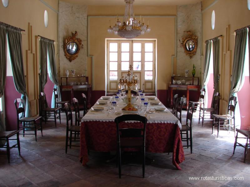
La Calera |
| 6,6 Km |
 |
Parque 93 |
| 7,4 Km |
 |
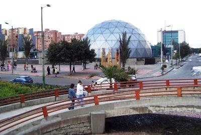
Parque Maloka |
| 13,1 Km |
 |
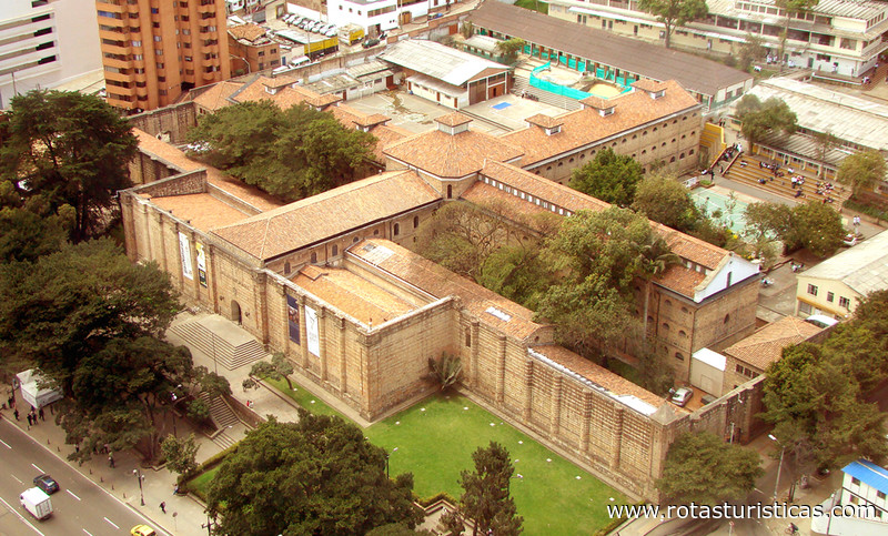
National Museum of Colombia |
| 14,5 Km |
 |
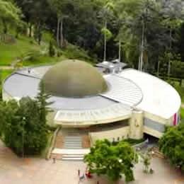
Planetario de Bogotá |
| 15,0 Km |
 |
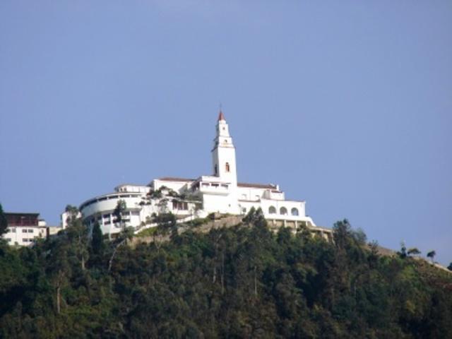
Santuario de Montserrat |
| 15,2 Km |
 |
Casa museo Simon Bolivar |
| 15,8 Km |
 |
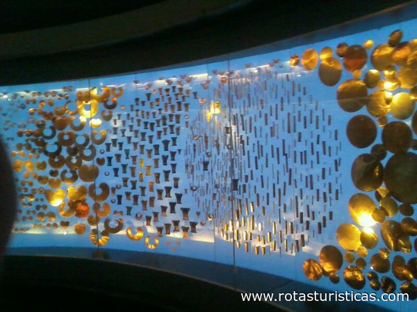
Museo del Oro |
| 16,1 Km |
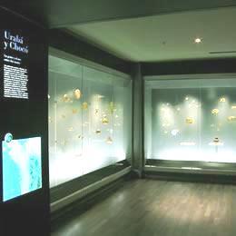 |
Gold Museum |
| 16,1 Km |
 |
Museo de Bogotá |
| 16,8 Km |
 |
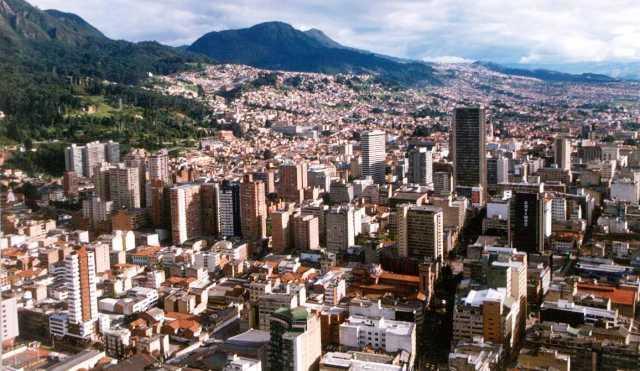
Bogotá Distrito Capital (d.c.) |
| 17,7 Km |
 |
Hotel reservation near Usaquen within a radius of 20 km

Why to book with RUTAS TURISTICAS
The best prices
Our partnerships with the world´s largest operators offer research on the best market prices.
More options
At Rotas Turisticos you can book the hotel, buy the air ticket, book the transfer from the airport to the hotel and vice versa, book the local excursions, rent the car, take travel insurance and consult the places to visit and where to go.
Holiday Tips & Destinations
Hundreds of holiday destinations with all the options that allow you to easily choose the destination that best suits your dream vacation.
RUTAS TURISTICAS
Links
Follow us on social networks


